Yorkshire Dales National Park
In 1954 an area of 1,770 square kilometres (680 sq mi) was designated the Yorkshire Dales National Park. Most of the National Park is in North Yorkshire, though part lies within Cumbria. However, the whole park lies within the traditional boundaries of Yorkshire, divided between the North Riding and the West Riding. The park is 50 miles (80 km) north east of Manchester; Leeds and Bradford lie to the south, while Kendal is to the west and Darlington to the east.
Over 20,000 residents live and work in the park, which attracts over eight million visitors every year. The area has a large collection of activities for visitors. For example, many people come to the “Dales” for walking or exercise. The National Park is crossed by several long-distance routes including the Pennine Way, the Dales Way, the Coast to Coast Path and the latest national trail - the Pennine Bridleway. Cycling is also popular and there are several cycleways.
The Park has its own museum, the Dales Countryside Museum, housed in a conversion of the Hawes railway station in Wensleydale in the north of the Park. The park has 5 visitor centres located in major destinations in the park. These are at:
Geography
Most of the dales in the Yorkshire Dales are named after their river or stream (eg Arkengarthdale, formed by Arkle Beck). The best-known exception to this rule is Wensleydale, which is named after the town of Wensley rather than the River Ure, although an older name for the dale is Yoredale. In fact, valleys all over Yorkshire are called “ (name of river) +dale”-but only the more northern Yorkshire valleys (and only the upper, rural, reaches) are included in the term “The Dales". For example, the southern boundary area lies in Wharfedale and Airedale. The lower reaches of these valleys are not usually included in the area, and Calderdale much further south, would never normally be referred to as part of “The Dales" even though it is a dale, is in Yorkshire, and the upper reaches are as scenic and rural as many valleys further north.
Geographically, the classical Yorkshire Dales spread to the north from the market and spa towns of Settle, Deepdale near Dent, Skipton, Ilkley and Harrogate in North Yorkshire, with most of the larger southern dales (e. g. Ribblesdale, Malhamdale and Airedale, Wharfedale and Nidderdale) running roughly parallel from north to south. The more northerly dales (e. g. Wensleydale, Swaledale and Teesdale) running generally from west to east. There are also many other smaller or lesser known dales (e. g. Arkengarthdale, Barbondale, Bishopdale, Clapdale, Coverdale, Dentdale and Deepdale, Garsdale, Kingsdale, Littondale, Langstrothdale, Raydale, Waldendale and the Washburn Valley) whose tributary streams and rivers feed into the larger valleys. [1]
|
|
|
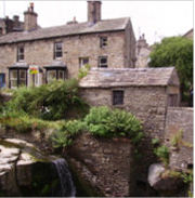
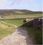
The characteristic scenery of the “Dales” is green upland pastures separated by dry-stone walls and grazed by sheep and cattle. The dales themselves are ‘U’ and ‘V’ shaped valleys, which were enlarged and shaped by glaciers, mainly in the most recent, Devensian ice age. The underlying rock is principally Carboniferous limestone (which results in a number of areas of limestone pavement) in places interspersed with shale and sandstone and topped with millstone grit. However, to the north of the Dent fault, the hills are principally older Silurian and Ordovician rocks, which make up the Howgill Fells.
Many of the upland areas consist of heather moorland, used for grouse shooting in the months following 12 August each year (the ‘Glorious Twelfth’).
Cave systems
Gaping Gill
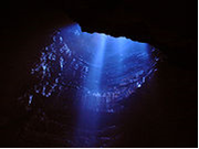
Because of the limestone that runs throughout the “Dales” there are extensive cave systems present across the area making it one of the major areas for caving in the UK. Many of these are open to the public for tours and for caving.
Lake District
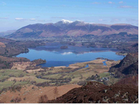
The Lake District, also known as The Lakes or Lakeland, is a rural area in North West England. A popular holiday destination, it is famous for its lakes and its mountains (or fells), and its associations with the early 19th century poetry and writings of William Wordsworth and the Lake Poets.
The central and most-visited part of the area is contained in the Lake District National Park, one of fourteen National Parks in the United Kingdom. It lies entirely within Cumbria, and is one of England's few mountainous regions. All the land in England higher than three thousand feet above sea level lies within the National Park, including Scafell Pike, the highest mountain in England
|
|
|
General geography

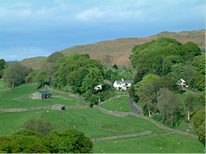
The Lake District is approximately 34 miles (55 km) across. Its features are a result of periods of glaciation, the most recent of which ended some 15,000 years ago. These include the ice-carved wide U-shaped valleys, many of which are now filled with the lakes that give the park its name. The upper regions contain a number of glacial cirques, which are typically filled with tarns. The higher fells are rocky, with lower fells being open moorland, notable for its wide bracken and heather coverage. Below the tree line, native oak woodlands sit alongside nineteenth century pine plantations. Much of the land is often boggy, due to the high rainfall. The Lake District is one of the most highly populated national parks. Its total area is near 885 square miles (2,292 km2), and the Lake District was designated as a National Park in 1951.
In Neolithic times, the Lake District was a major source of stone axes, examples of which have been found all over Britain. The primary site, on the slopes of the Langdale Pikes, is sometimes described as a "stone axe factory" of the Langdale axe industry. Some of the earliest stone circles in Britain are connected with this industry.
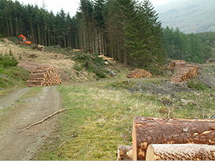
Since Roman times, farming, in particular of sheep, was the major industry in the region. The breed most closely associated with the area is the tough Herdwick, with Rough Fell and Swaledale sheep also common. Sheep farming remains important both for the economy of the region and for preserving the landscape which visitors want to see. Features such as dry stone walls, for example, are there as a result of sheep farming. Some land is also used for silage and dairy farming. There are extensive plantations of non-native pine trees.
The area was badly affected by the foot-and-mouth outbreak across the United Kingdom in 2001. Thousands of sheep, grazing on the fellsides across the District, were destroyed. In replacing the sheep, one problem to overcome was that many of the lost sheep were heafed, that is, they knew their part of the unfenced fell and did not stray, with this knowledge being passed between generations. With all the sheep lost at once, this knowledge has to be re-learnt and some of the fells have had discreet electric fences strung across them for a period of five years, to allow the sheep to "re-heaf".
|
|
|
Mining, particularly of copper, lead (often associated with quantities of silver), baryte, graphite and slate, was historically a major Lakeland industry, mainly from the 16th century to the 19th century. Coppiced woodland was used extensively to provide charcoal for smelting. Some mining still takes place today-for example slate mining continues at the Honister Mines, at the top of Honister Pass. Abandoned mine-workings can be found on fell-sides throughout the district. The locally-mined graphite led to the development of the pencil industry, especially around Keswick.
In the middle of the 19th century, half the world textile industry's bobbin supply came from the Lake District area. Over the past century, however, tourism has grown rapidly to become the area's primary source of income.
Development of tourism
Early visitors to the Lake District, who travelled for the education and pleasure of the journey, include Celia Fiennes who in 1698 undertook a journey the length of England, including riding through Kendal and over Kirkstone Pass into Patterdale. Her experiences and impressions were published in her book Great Journey to Newcastle and Cornwall:
As I walked down at this place I was walled on both sides by those inaccessible high rocky barren hills which hang over one’s head in some places and appear very terrible; and from them springs many little currents of water from the sides and clefts which trickle down to some lower part where it runs swiftly over the stones and shelves in the way, which makes a pleasant rush and murmuring noise and like a snowball is increased by each spring trickling down on either side of those hills, and so descends into the bottoms which are a Moorish ground in which in many places the waters stand, and so form some of those Lakes as it did here.
|
|
|
In 1724, Daniel Defoe published the first volume of A Tour Thro' the Whole Island of Great Britain. He commented on Westmorland that it was:
the wildest, most barren and frightful of any that I have passed over in England, or even Wales itself; the west side, which borders on Cumberland, is indeed bounded by a chain of almost unpassable mountains which, in the language of the country, are called fells.
Towards the end of the 18th century, the area was becoming more popular with travellers. This was partly a result of wars in Continental Europe, restricting the possibility of travel there. In 1778 Father Thomas West produced A Guide to the Lakes, which began the era of modern tourism.
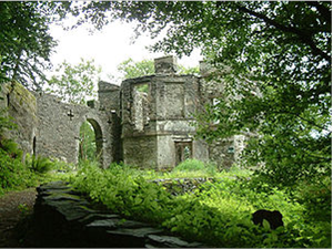
West listed "stations"-viewpoints where tourists could enjoy the best views of the landscape, being encouraged to appreciated the formal qualities of the landscape and to apply aesthetic values. At some of these stations, buildings were erected to help this process. The remains of Claife Station (on the western shore of Windermere below Claife Heights) can be visited today.
William Wordsworth published his Guide to the Lakes in 1810, and by 1835 it had reached its fifth edition, now called A Guide through the District of the Lakes in the North of England. This book was particularly influential in popularising the region. Wordsworth's favourite valley was Dunnerdale or the Duddon Valley nestling in the south-west of the Lake District.
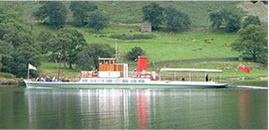
The railways led to another expansion in tourism. The Kendal and Windermere Railway was the first to penetrate the Lake District, reaching Kendal in 1846 and Windermere in 1847. The line to Coniston opened in 1848 (although until 1857 this was only linked to the national network with ferries between Fleetwood and Barrow-in-Furness); the line from Penrith through Keswick to Cockermouth in 1865; and the line to Lakeside at the foot of Windermere in 1869. The railways, built with traditional industry in mind, brought with them a huge increase in the number of visitors, thus contributing to the growth of the tourism industry. Railway services were supplemented by steamer boats on the major lakes of Ullswater, Windermere, Coniston Water, and Derwent Water.
The growth in tourist numbers continued into the age of the motor car, when railways began to be closed or run down. The formation of the Lake District National Park in 1951 recognised the need to protect the Lake District environment from excessive commercial or industrial exploitation, preserving that which visitors come to see, without (so far) any restriction on the movement of people into and around the district. The M6 Motorway helped bring traffic to the Lakes, passing up its eastern flank. The narrow roads present a challenge for traffic flow and, from the 1960s, certain areas have been very congested.
Whilst the roads and railways provided easier access to the area, many people were drawn to the Lakes by the publication of the Pictorial Guide to the Lakeland Fells by Alfred Wainwright. First published between 1952 and 1965, these books provided detailed information on 214 peaks across the region, with carefully hand-drawn maps and panoramas, and also stories and asides which add to the colour of the area. They are still used by many visitors to the area as guides for walking excursions, with the ultimate goal of bagging the complete list of Wainwrights. The famous guides are being revised by Chris Jesty to reflect changes, mainly in valley access and paths.
Since the early 1960s, the park has hired rangers to monitor the grounds to cope with increasing tourism and development, the first being John Wyatt, who has since written a number of guide books. He was joined two years later by a second, and since then the number of rangers has been rising.
The area has also become associated with writer Beatrix Potter. A number of tourists visit to see her family home, with particularly large numbers coming from Japan.
Tourism has now become the park's major industry, with about 14 million visitors each year, mainly from the UK's larger settlements, China, Japan, Spain, Germany and the USA. [3] Windermere Lake Steamers are now the UK's second most popular charging tourist attraction and the local economy is dependent upon tourists. The negative impact of tourism has been seen, however. Soil erosion, caused by walking, is now a significant problem, with millions of pounds being spent to protect over-used paths. In 2006, two Tourist Information Centres in the National Park were closed.
Cultural tourism is becoming an increasingly important part of the wider tourist industry. The Lake District's links with a wealth of artists and writers and its strong history of providing summer theatre performances in the old Blue Box of Century Theatre are strong attractions for visiting tourists. The tradition of theatre is carried on by venues such as Theatre by the Lake in Keswick with its Summer Season of six plays in repertoire, Christmas and Easter productions and the many literature, film, mountaineering, jazz and creative arts festivals.
Conclusion
When I was doing this project I learned a lot of incredible and interesting information about the parks.
For exmaple: That Dartmoor has inspired a number of artists and writers, such as Sir Arthur Conan Doyle in The Hound of the Baskervilles and The Adventure of Silver Blaze, Eden Phillpotts, Beatrice Chase, Agatha Christie and the Reverend Sabine Baring-Gould. And that the first roads in the Peak District National Park were constructed by the Romans. I get to know the legend about phantom cat in Exmoor park and ect.
After this I can do my own conclusion: despite the fact that all of the parks British, they are totally different. Each its own history, legends ect. Each is unique. Humanity must establish and maintain such beautiful place on Earth.

Additional material
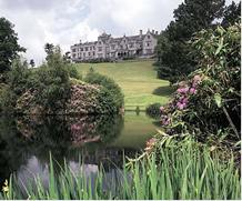
Bovey Castle. Dartmoor National ParkVillarrica
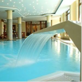
Lake District Park Hotel
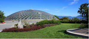

Queen Elizabeth Park

Yorkshire Dales National Park
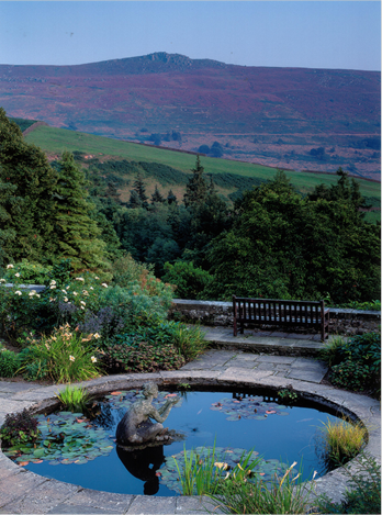
Dartmoor National Park
Literature
1. www.wikipedia.com
2. www.travel.com
3. www.greatbritan.com
4. www.tour-england.net
5. www.visitnewforest.com
Дата добавления: 2019-11-16; просмотров: 172; Мы поможем в написании вашей работы! |

Мы поможем в написании ваших работ!